Hallingskarvet
A national park with a 35 km sheer rock wall. The Prestholt trail climbs right onto the plateau.
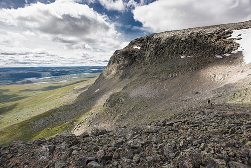
The facts
| Elevation | 1500 m |
| Coordinates | 60.6291, 7.6761 |
| Time to allow | 6 h |
What to see
- Hallingskarvet nasjonalpark Hike
- Prestholtstien Hike
A stone-laid sherpa path up the massif — steep, but well marked. - Folarskardnuten Hike
The highest point of Hallingskarvet, 1933 m.
Month by month
| Month | Daylight | Day high | Wet days | Access |
|---|---|---|---|---|
| January | 6.6 h | -8.3 °C | 17 | Open |
| February | 9.1 h | -8.5 °C | 14 | Open |
| March | 11.7 h | -6.4 °C | 15 | Open |
| April | 14.6 h | -2.4 °C | 13 | Open |
| May | 17.3 h | 1.7 °C | 13 | Open |
| June | 19.1 h | 6.9 °C | 16 | Open |
| July | 18.3 h | 10.9 °C | 19 | Open |
| August | 15.8 h | 9.9 °C | 18 | Open |
| September | 12.9 h | 5.6 °C | 16 | Open |
| October | 10.2 h | -0.6 °C | 16 | Open |
| November | 7.4 h | -5.4 °C | 16 | Open |
| December | 5.7 h | -7.7 °C | 17 | Open |
Background
Hallingskarvet is a mountain range in southern Norway stretching from Geilo to Finse in Vestland and Buskerud counties. The highest point is the 1,933-metre (6,342 ft) tall mountain Folarskardnuten in Hol Municipality in Buskerud county. The mountains run through Aurland Municipality and Ulvik Municipality in Vestland county and Hol Municipality in Buskerud county.
Source: Wikipedia (CC BY-SA)
On these routes
- Oslo–Bergen — The Bergen Line across Hardangervidda, with the Flåm Railway and Nærøyfjord along the way.
- Bergen–Trondheim — The fjords and Hardangervidda east to Oslo, then north over Dovrefjell to Nidaros.