Hallingskeid
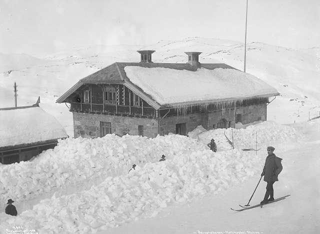
An unstaffed high-mountain halt in the middle of the wilderness — a trekking hut and snow sheds from the navvy era.
The facts
| Elevation | 1110 m |
| Coordinates | 60.6679, 7.2522 |
| Time to allow | 2 h |
What to see
- Rallarvegen Activity
- Hardangervidda Hike
Month by month
| Month | Daylight | Day high | Wet days | Access |
|---|---|---|---|---|
| January | 6.6 h | -5.3 °C | 18 | Open |
| February | 9.1 h | -5.6 °C | 15 | Open |
| March | 11.7 h | -3.5 °C | 16 | Open |
| April | 14.6 h | 0.5 °C | 13 | Open |
| May | 17.3 h | 4.6 °C | 15 | Open |
| June | 19.1 h | 9.7 °C | 17 | Open |
| July | 18.3 h | 13.2 °C | 19 | Open |
| August | 15.8 h | 12.4 °C | 18 | Open |
| September | 12.9 h | 8.3 °C | 16 | Open |
| October | 10.1 h | 2.3 °C | 16 | Open |
| November | 7.4 h | -2.5 °C | 16 | Open |
| December | 5.7 h | -4.8 °C | 17 | Open |
Background
Hallingskeid Station (Norwegian: Hallingskeid stasjon) is a train station on the Bergen Line in Ulvik Municipality in Vestland county, Norway. Located at an elevation of 1,110 meters (3,640 ft) above mean sea level, the station is situated inside a snow tunnel. It opened along with the central section of the line on 10 June 1908 and remained as a staffed station until 1982.
Source: Wikipedia (CC BY-SA)
On these routes
- Oslo–Bergen — The Bergen Line across Hardangervidda, with the Flåm Railway and Nærøyfjord along the way.
- Bergen–Trondheim — The fjords and Hardangervidda east to Oslo, then north over Dovrefjell to Nidaros.