Åndalsnes
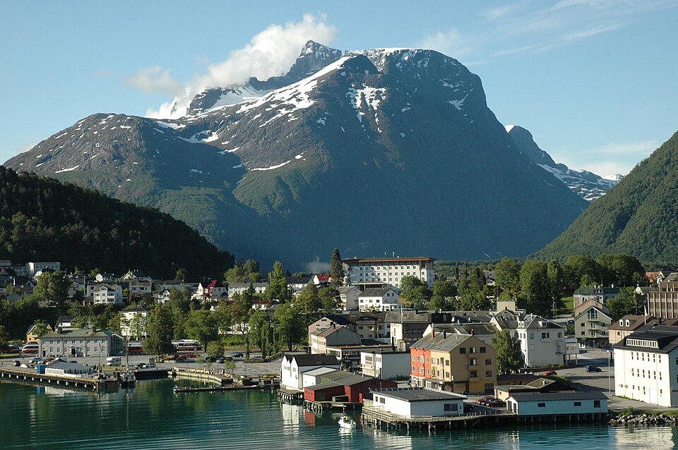
Where the Rauma Line ends and the Romsdal fjord begins. The town is wedged between the Nesaksla peak and the water, with a cable car up from the centre.
The facts
| Elevation | 5 m |
| Coordinates | 62.5674, 7.6902 |
| Time to allow | 5 h |
What to see
- Romsdalsgondolen Activity
From the town centre to 708 m in five minutes, with a restaurant at the top. - Norsk tindesenter Museum
- Rampestreken Hike
- Nesaksla Hike
- Raumabanen Sight
The train through Romsdalen, past the Troll Wall and over the Kylling bridge.
Month by month
| Month | Daylight | Day high | Wet days | Access |
|---|---|---|---|---|
| January | 6 h | -0.8 °C | 18 | Open |
| February | 8.9 h | 0.3 °C | 16 | Open |
| March | 11.7 h | 3.3 °C | 17 | Open |
| April | 14.9 h | 7.5 °C | 15 | Open |
| May | 17.9 h | 11.3 °C | 17 | Open |
| June | 20 h | 15.2 °C | 18 | Open |
| July | 19 h | 18.4 °C | 20 | Open |
| August | 16.1 h | 18.1 °C | 20 | Open |
| September | 13 h | 14.6 °C | 17 | Open |
| October | 10 h | 8.3 °C | 17 | Open |
| November | 7 h | 2.2 °C | 16 | Open |
| December | 5 h | -0.7 °C | 18 | Open |
Background
is a town in Rauma Municipality in Møre og Romsdal county, Norway. Åndalsnes is also the administrative center of Rauma Municipality. It is located along the Isfjorden, at the mouth of the river Rauma, at the north end of the Romsdalen valley.
Source: Wikipedia (CC BY-SA)
On these routes
- Dombås–Ålesund — The Troll Wall, Trollstigen and the Geirangerfjord — World Heritage and two national tourist roads, starting where the Dovre Line branches off.