Dombås–Ålesund
The Troll Wall, Trollstigen and the Geirangerfjord — World Heritage and two national tourist roads, starting where the Dovre Line branches off.
The facts
| stops | 13 |
| End to end | 10 h |
| Travel by | kollektiv, bil, buss |
| Home | Dombås → Ålesund |
When it is busy
| Month | When it is busy |
|---|---|
| January | 12 % |
| February | 15 % |
| March | 20 % |
| April | 20 % |
| May | 33 % |
| June | 63 % |
| July | 100 % |
| August | 78 % |
| September | 40 % |
| October | 24 % |
| November | 20 % |
| December | 13 % |
Busiest: July. Quietest: January. Guest arrivals per month as a share of the route's own busiest month. Figures from Statistics Norway, averaged over seven full years. They count people who stay overnight, so day trippers and cruise passengers are not included.
Stops along the way
- Dombås · 0 h
Where the Rauma Line branches off towards Åndalsnes and the Troll Wall — a junction on the edge of Dovrefjell. - Bjorli · 1 h
The railway village at the top of Romsdalen, with a ski resort on the slope above and Reinheimen National Park across the valley. - Trollveggen · 2.2 h
Europe's tallest vertical rock face: 1,100 metres straight up, its summit overhanging the base by fifty metres. BASE jumping has been banned here since 1986. - Åndalsnes · 2.5 h
Where the Rauma Line ends and the Romsdal fjord begins. The town is wedged between the Nesaksla peak and the water, with a cable car up from the centre. - Romsdalseggen · 3 h
The ridge above Åndalsnes, walked as a traverse from Vengedalen down to the town — the Troll Wall, Romsdalshorn and the fjord on either side the whole way. - Trollstigen · 4 h
Eleven hairpin bends at a nine per cent gradient up from Isterdalen, between the peaks called the Bishop and the King, with the Stig waterfall dropping 320 metres beside the road. - Gudbrandsjuvet · 4.6 h
A gorge five metres wide where the Valldøla river has cut 25 metres into the rock, with walkways suspended out over the water. - Valldal · 5.2 h
The strawberry village at the head of the Norddal fjord, known for berries that ripen late and taste stronger for it. The ferry across to Eidsdal leaves from here. - Ørnesvingen · 6.2 h
The highest of eleven bends on the Eagle Road, with the viewing platform that gives the photograph of the Geirangerfjord everyone knows — the Seven Sisters waterfall straight across the water. - Geiranger · 6.6 h
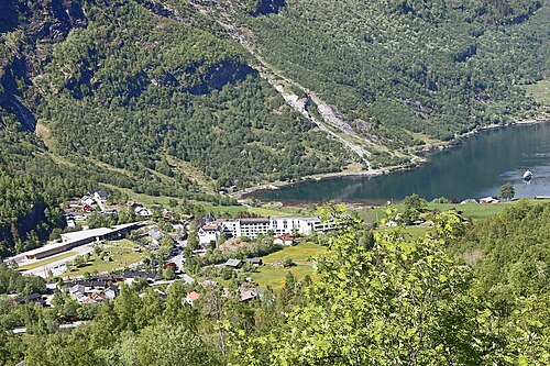
At the head of the Geirangerfjord, on the UNESCO World Heritage list alongside the Nærøyfjord. The walls rise 1,400 metres straight up, and the farms clinging to them were only abandoned in the twentieth century. - Dalsnibba · 7.2 h
Europe's highest fjord view reachable by road: 1,476 m, with the Geirangerfjord 1,500 metres straight down and the Jostedalsbreen glacier on the horizon. - Hellesylt · 8.5 h
The other end of the Geirangerfjord, where the ferry docks and the Hellesylt waterfall drops through the village between the houses. - Ålesund · 10 h
The town burned down in 1904 and was rebuilt in Art Nouveau in three years — towers, spires and ornament across the whole centre, spread over islands between the sounds.