Gudbrandsjuvet
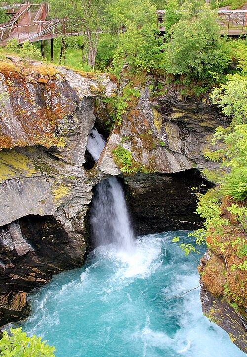
A gorge five metres wide where the Valldøla river has cut 25 metres into the rock, with walkways suspended out over the water.
The facts
| Elevation | 200 m |
| Coordinates | 62.3305, 7.4698 |
| Time to allow | 1 h |
What to see
- Gudbrandsjuvet Sight
Walkways suspended over a gorge five metres wide, 25 metres above the river. - Juvet landskapshotell Food
In winter
The gorge sits on the Valldal side of Trollstigen, and the stretch up from Valldal is normally ploughed even when the hairpins above are shut. The walkways can be iced and closed for safety — check before you plan the day around it.
Month by month
| Month | Daylight | Day high | Wet days | Access |
|---|---|---|---|---|
| January | 6.1 h | -1.4 °C | 18 | Open |
| February | 8.9 h | -0.8 °C | 16 | Open |
| March | 11.7 h | 1.8 °C | 17 | Open |
| April | 14.8 h | 6.1 °C | 14 | Open |
| May | 17.8 h | 9.8 °C | 16 | Open |
| June | 19.9 h | 14.3 °C | 18 | Open |
| July | 18.9 h | 18 °C | 19 | Open |
| August | 16.1 h | 17.6 °C | 20 | Open |
| September | 13 h | 13.7 °C | 17 | Open |
| October | 10 h | 7.2 °C | 17 | Open |
| November | 7 h | 1.6 °C | 15 | Open |
| December | 5.1 h | -1 °C | 18 | Open |
Background
Gudbrandsjuvet er et elvegjel i elva Valldøla i Fjord kommune (tidligere Norddal) på Sunnmøre. Besøkssenter og utsiktsplattformer inngår i Nasjonal turistvei langs fylkesvei 63 fra Geiranger til Trollstigen. Fylkesvei 63 krysser elva i bru over gjelet.
Source: Wikipedia (CC BY-SA)
On these routes
- Dombås–Ålesund — The Troll Wall, Trollstigen and the Geirangerfjord — World Heritage and two national tourist roads, starting where the Dovre Line branches off.