Trollstigen
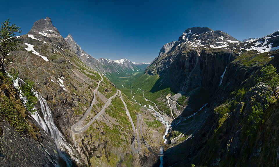
Eleven hairpin bends at a nine per cent gradient up from Isterdalen, between the peaks called the Bishop and the King, with the Stig waterfall dropping 320 metres beside the road.
The facts
| Elevation | 858 m |
| Coordinates | 62.4533, 7.6637 |
| Time to allow | 2 h |
What to see
- Trollstigen Activity
Eleven hairpins at a nine per cent gradient. A national tourist road, open in season. - Trollstigen utsiktsplattform Viewpoint
- Stigfossen Sight
- Kløvstien Hike
In winter
Trollstigen closes for the winter, normally October to late May, and opens later in heavy snow years. There is no way over — you go round, via Valldal and the ferry.
Month by month
| Month | Daylight | Day high | Wet days | Access |
|---|---|---|---|---|
| January | 6 h | -6 °C | 18 | Closed |
| February | 8.9 h | -5.2 °C | 16 | Closed |
| March | 11.7 h | -2.4 °C | 17 | Closed |
| April | 14.9 h | 1.8 °C | 15 | Closed |
| May | 17.8 h | 5.7 °C | 17 | Closed |
| June | 19.9 h | 9.9 °C | 19 | Open |
| July | 18.9 h | 13.5 °C | 20 | Open |
| August | 16.1 h | 13.1 °C | 20 | Open |
| September | 13 h | 9.4 °C | 18 | Open |
| October | 10 h | 2.8 °C | 17 | Closed |
| November | 7 h | -3 °C | 16 | Closed |
| December | 5 h | -5.6 °C | 18 | Closed |
Background
Trollstigen (or trollstigvegen; English: The troll path) is a serpentine mountain road and pass in Rauma Municipality, Møre og Romsdal County, Norway. It is part of Norwegian County Road 63 that connects the town of Åndalsnes in Rauma and the village of Valldal in Fjord Municipality. It is a popular tourist attraction for its steep incline of 10% and eleven hairpin bends up a steep mountainside.
Source: Wikipedia (CC BY-SA)
On these routes
- Dombås–Ålesund — The Troll Wall, Trollstigen and the Geirangerfjord — World Heritage and two national tourist roads, starting where the Dovre Line branches off.