Dalsnibba
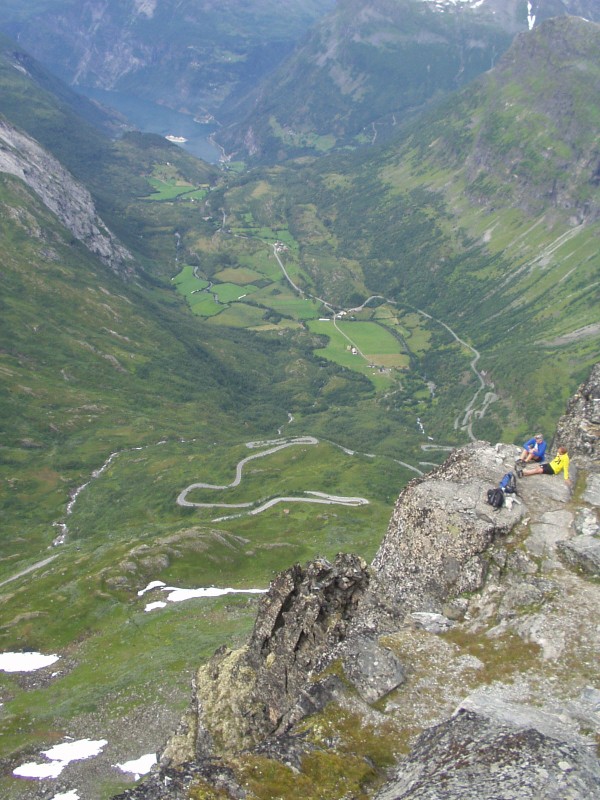
Europe's highest fjord view reachable by road: 1,476 m, with the Geirangerfjord 1,500 metres straight down and the Jostedalsbreen glacier on the horizon.
The facts
| Elevation | 1476 m |
| Coordinates | 62.0478, 7.2713 |
| Time to allow | 2 h |
What to see
- Geiranger Skywalk Viewpoint
1,476 m, with the fjord 1,500 metres straight down. Europe's highest fjord view reachable by road. - Nibbevegen Activity
- Djupvatnet Sight
In winter
The toll road up to 1,476 m is seasonal, normally open from late May to October. The view down the Geirangerfjord does not exist in winter.
Month by month
| Month | Daylight | Day high | Wet days | Access |
|---|---|---|---|---|
| January | 6.2 h | -9.1 °C | 19 | Closed |
| February | 9 h | -8.9 °C | 16 | Closed |
| March | 11.7 h | -6.7 °C | 18 | Closed |
| April | 14.8 h | -2.5 °C | 14 | Closed |
| May | 17.7 h | 1.4 °C | 15 | Closed |
| June | 19.7 h | 6.2 °C | 18 | Open |
| July | 18.8 h | 10 °C | 20 | Open |
| August | 16 h | 9.3 °C | 19 | Open |
| September | 13 h | 5.3 °C | 17 | Open |
| October | 10 h | -1.2 °C | 17 | Closed |
| November | 7.1 h | -6.4 °C | 16 | Closed |
| December | 5.2 h | -8.6 °C | 19 | Closed |
Background
Dalsnibba is a mountain in Stranda Municipality in Møre og Romsdal county, Norway. It is located at the end of the Geiranger valley, about 7 km (4 mi) south of the village of Geiranger and the Geirangerfjorden. The 2-square-kilometre (0.8 sq mi) lake Djupvatnet lies directly to the southeast of the mountain.
Source: Wikipedia (CC BY-SA)
On these routes
- Dombås–Ålesund — The Troll Wall, Trollstigen and the Geirangerfjord — World Heritage and two national tourist roads, starting where the Dovre Line branches off.