Hellesylt
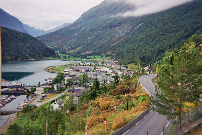
The other end of the Geirangerfjord, where the ferry docks and the Hellesylt waterfall drops through the village between the houses.
The facts
| Elevation | 10 m |
| Coordinates | 62.0856, 6.8698 |
| Time to allow | 2 h |
What to see
- Hellesyltfossen Sight
- Ferje til Geiranger Activity
- Sunnylvsfjorden Hike
- Peer Gynt-galleriet Museum
In winter
Rv60 through Hellesylt is open all year, but the ferry to Geiranger — the thing that makes the place a through route — runs in season only.
Month by month
| Month | Daylight | Day high | Wet days | Access |
|---|---|---|---|---|
| January | 6.1 h | 0.1 °C | 18 | Open |
| February | 8.9 h | 0.7 °C | 17 | Open |
| March | 11.7 h | 3.4 °C | 18 | Open |
| April | 14.8 h | 7.5 °C | 14 | Open |
| May | 17.7 h | 11.4 °C | 16 | Open |
| June | 19.7 h | 15.8 °C | 17 | Open |
| July | 18.8 h | 19.3 °C | 18 | Open |
| August | 16 h | 18.6 °C | 19 | Open |
| September | 13 h | 14.7 °C | 17 | Open |
| October | 10 h | 8.4 °C | 17 | Open |
| November | 7.1 h | 3.2 °C | 16 | Open |
| December | 5.2 h | 0.7 °C | 19 | Open |
Background
Hellesylt is a small village in Stranda Municipality in Møre og Romsdal county, Norway. The village lies at the head of the Sunnylvsfjorden, which is a branch of the Storfjorden, and which the Geirangerfjorden in turn branches off nearby. The 0.43-square-kilometre (110-acre) village has a population (2024) of 240 and a population density of 558 inhabitants per square kilometre (1,450/sq mi).
Source: Wikipedia (CC BY-SA)
On these routes
- Dombås–Ålesund — The Troll Wall, Trollstigen and the Geirangerfjord — World Heritage and two national tourist roads, starting where the Dovre Line branches off.