Ørnesvingen
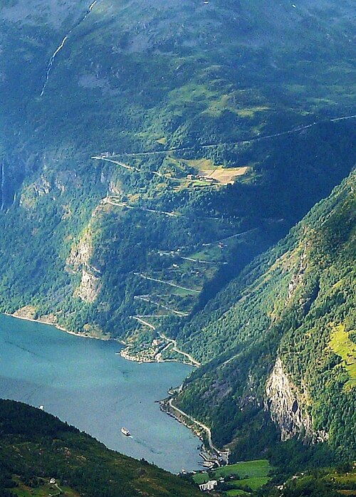
The highest of eleven bends on the Eagle Road, with the viewing platform that gives the photograph of the Geirangerfjord everyone knows — the Seven Sisters waterfall straight across the water.
The facts
| Elevation | 620 m |
| Coordinates | 62.1262, 7.1667 |
| Time to allow | 1 h |
What to see
- Ørnesvingen Viewpoint
The platform with the view everyone knows: the Geirangerfjord below and the Seven Sisters straight across. - Ørnevegen Activity
Month by month
| Month | Daylight | Day high | Wet days | Access |
|---|---|---|---|---|
| January | 6.1 h | -4.7 °C | 18 | Open |
| February | 8.9 h | -3.9 °C | 16 | Open |
| March | 11.7 h | -1.2 °C | 17 | Open |
| April | 14.8 h | 3.1 °C | 14 | Open |
| May | 17.7 h | 7 °C | 16 | Open |
| June | 19.7 h | 11.6 °C | 18 | Open |
| July | 18.8 h | 15.2 °C | 19 | Open |
| August | 16 h | 14.7 °C | 20 | Open |
| September | 13 h | 10.7 °C | 17 | Open |
| October | 10 h | 4.1 °C | 17 | Open |
| November | 7.1 h | -1.6 °C | 15 | Open |
| December | 5.2 h | -4.2 °C | 18 | Open |
Background
Ørnevegen er et vegstykke og fjellovergang på fylkesvei 63 (tidligere riksvei) mellom Eidsdal og Geiranger. Vegen består av elleve hårnålssvinger som strekker seg fra fjorden ved Grande til fjellovergangen ved Korsmyra. Ørnevegen har siden 2012 vært offisiell del av nasjonal turistveg Trollstigen-Geiranger, og ble derfor årene før opprustet, spesielt ved utkikkspunktet Ørnesvingen.
Source: Wikipedia (CC BY-SA)
On these routes
- Dombås–Ålesund — The Troll Wall, Trollstigen and the Geirangerfjord — World Heritage and two national tourist roads, starting where the Dovre Line branches off.