Geiranger
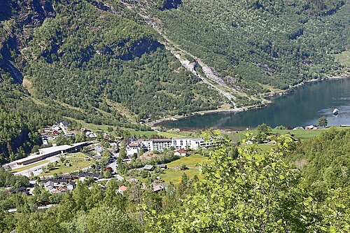
At the head of the Geirangerfjord, on the UNESCO World Heritage list alongside the Nærøyfjord. The walls rise 1,400 metres straight up, and the farms clinging to them were only abandoned in the twentieth century.
The facts
| Elevation | 5 m |
| Coordinates | 62.1031, 7.2049 |
| Time to allow | 6 h |
What to see
- Geirangerfjord-cruise Activity
Ninety minutes beneath the Seven Sisters, the Suitor and the abandoned farms in the mountainside. - Norsk fjordsenter Museum
- Storsæterfossen Hike
- Flydalsjuvet Viewpoint
- Skageflå Sight
In winter
The village is reachable all year over Ørnevegen and the Eidsdal–Linge ferry, but Dalsnibba is shut, the ferry to Hellesylt is seasonal, and most hotels and shops close for the winter. The fjord is there, and almost nobody else.
Month by month
| Month | Daylight | Day high | Wet days | Access |
|---|---|---|---|---|
| January | 6.1 h | -0.2 °C | 18 | Open |
| February | 8.9 h | 0.4 °C | 16 | Open |
| March | 11.7 h | 3 °C | 17 | Open |
| April | 14.8 h | 7.3 °C | 14 | Open |
| May | 17.7 h | 11.1 °C | 15 | Open |
| June | 19.7 h | 15.7 °C | 18 | Open |
| July | 18.8 h | 19.3 °C | 20 | Open |
| August | 16 h | 18.8 °C | 19 | Open |
| September | 13 h | 14.9 °C | 17 | Open |
| October | 10 h | 8.4 °C | 17 | Open |
| November | 7.1 h | 2.8 °C | 16 | Open |
| December | 5.2 h | 0.3 °C | 18 | Open |
Background
Geiranger is a small tourist village in Sunnmøre region of Møre og Romsdal county in the western part of Norway. It is located in Stranda Municipality and at the end of the Geirangerfjorden, which is a branch of the large Storfjorden. The nearest city is Ålesund.
Source: Wikipedia (CC BY-SA)
On these routes
- Dombås–Ålesund — The Troll Wall, Trollstigen and the Geirangerfjord — World Heritage and two national tourist roads, starting where the Dovre Line branches off.