Eidfjord
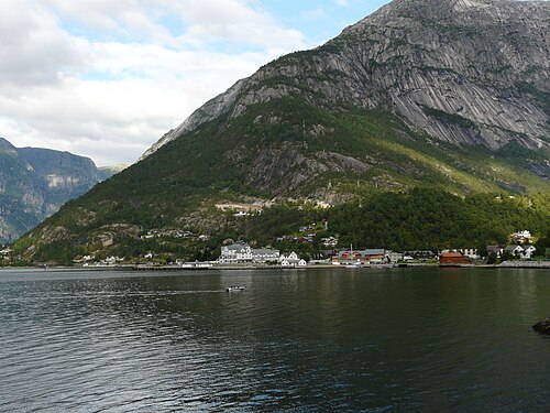
Where the Hardangerfjord ends and the plateau begins — a cruise port and the Hardangervidda Nature Centre.
The facts
| Elevation | 10 m |
| Coordinates | 60.4665, 7.0671 |
| Time to allow | 3 h |
What to see
- Hardangervidda Natursenter Museum
- Måbødalen Hike
- Kjeåsen Viewpoint
A mountain farm 530 metres straight above the fjord, up a single-lane tunnel road.
Month by month
| Month | Daylight | Day high | Wet days | Access |
|---|---|---|---|---|
| January | 6.6 h | 0.4 °C | 19 | Open |
| February | 9.2 h | 0.1 °C | 16 | Open |
| March | 11.7 h | 2.4 °C | 17 | Open |
| April | 14.6 h | 6.7 °C | 14 | Open |
| May | 17.3 h | 11 °C | 15 | Open |
| June | 19 h | 16.2 °C | 17 | Open |
| July | 18.2 h | 19.7 °C | 18 | Open |
| August | 15.7 h | 18.8 °C | 17 | Open |
| September | 12.9 h | 14.4 °C | 17 | Open |
| October | 10.2 h | 8.2 °C | 17 | Open |
| November | 7.4 h | 3.3 °C | 17 | Open |
| December | 5.8 h | 1 °C | 18 | Open |
Background
Eidfjord is a municipality in Vestland county, Norway. The municipality is located in the traditional district of Hardanger. The administrative centre of the municipality is the village of Eidfjord, where the majority of the municipal population lives.
Source: Wikipedia (CC BY-SA)
On these routes
- Oslo–Bergen — The Bergen Line across Hardangervidda, with the Flåm Railway and Nærøyfjord along the way.
- Stavanger–Bergen — The Pulpit Rock, Kjeragbolten and Trolltunga on one route — the three hikes people come to Norway for, and not one of them has a road to it.
- Bergen–Trondheim — The fjords and Hardangervidda east to Oslo, then north over Dovrefjell to Nidaros.