Lysefjorden
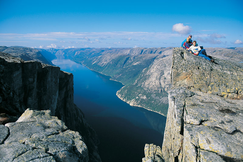
42 kilometres of fjord between walls rising more than 1,000 metres straight out of the water, with the Pulpit Rock on one side and Kjerag on the other.
The facts
| Elevation | 0 m |
| Coordinates | 59.0109, 6.3446 |
| Time to allow | 4 h |
What to see
- Rødne Fjord Cruise Activity
Three hours into the Lysefjord from Stavanger, beneath the Pulpit Rock and up to the Hengjane waterfall. - Hengjanefossen Viewpoint
- Vagabonds Cave Sight
Month by month
| Month | Daylight | Day high | Wet days | Access |
|---|---|---|---|---|
| January | 7 h | 2.6 °C | 19 | Open |
| February | 9.3 h | 2.6 °C | 16 | Open |
| March | 11.8 h | 4.5 °C | 17 | Open |
| April | 14.5 h | 8.7 °C | 15 | Open |
| May | 16.9 h | 13.7 °C | 15 | Open |
| June | 18.5 h | 17.2 °C | 16 | Open |
| July | 17.8 h | 19.3 °C | 18 | Open |
| August | 15.5 h | 18.8 °C | 18 | Open |
| September | 12.9 h | 15.3 °C | 17 | Open |
| October | 10.3 h | 10.5 °C | 18 | Open |
| November | 7.7 h | 6.1 °C | 17 | Open |
| December | 6.2 h | 3.5 °C | 19 | Open |
Background
Lysefjord or Lysefjorden is a fjord located in the Ryfylke area in Rogaland county in southwestern Norway. The 42-kilometre (26 mi) long fjord lies in Strand Municipality and Sandnes Municipality, about 25 kilometres (16 mi) east of the city of Stavanger. The name means light fjord, and is said to be derived from the lightly coloured granite rocks along its sides.
Source: Wikipedia (CC BY-SA)
On these routes
- Stavanger–Bergen — The Pulpit Rock, Kjeragbolten and Trolltunga on one route — the three hikes people come to Norway for, and not one of them has a road to it.