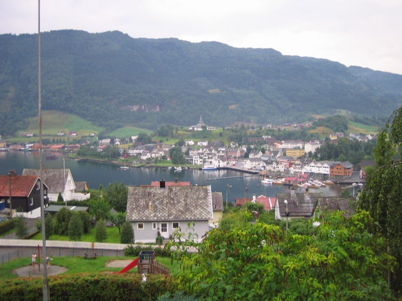
Norheimsund
Steinsdalsfossen, a waterfall you can walk behind, and the Hardanger Maritime Centre building wooden boats.
The facts
| Elevation | 5 m |
| Coordinates | 60.3715, 6.1466 |
| Time to allow | 3 h |
What to see
- Steinsdalsfossen Sight
- Hardanger Fartøyvernsenter Museum
Month by month
| Month | Daylight | Day high | Wet days | Access |
|---|---|---|---|---|
| January | 6.6 h | 0.4 °C | 19 | Open |
| February | 9.2 h | 1 °C | 17 | Open |
| March | 11.8 h | 3.6 °C | 18 | Open |
| April | 14.6 h | 7.7 °C | 15 | Open |
| May | 17.2 h | 12.1 °C | 16 | Open |
| June | 19 h | 16.2 °C | 17 | Open |
| July | 18.2 h | 19 °C | 20 | Open |
| August | 15.7 h | 18.4 °C | 19 | Open |
| September | 12.9 h | 14.7 °C | 18 | Open |
| October | 10.2 h | 9.1 °C | 18 | Open |
| November | 7.5 h | 3.5 °C | 18 | Open |
| December | 5.8 h | 0.8 °C | 19 | Open |
Background
Norheimsund is the administrative centre of Kvam Municipality in Vestland county, Norway. The village is located on the northern side of the Hardangerfjord, about 80 kilometres (50 mi) from the city of Bergen. The village of Øystese lies about 4 kilometres (2.5 mi) to the northeast and the village of Vikøy lies about 3 kilometres (1.9 mi) southeast of Norheimsund.
Source: Wikipedia (CC BY-SA)
On these routes
- Oslo–Bergen — The Bergen Line across Hardangervidda, with the Flåm Railway and Nærøyfjord along the way.
- Stavanger–Bergen — The Pulpit Rock, Kjeragbolten and Trolltunga on one route — the three hikes people come to Norway for, and not one of them has a road to it.
- Bergen–Trondheim — The fjords and Hardangervidda east to Oslo, then north over Dovrefjell to Nidaros.