Sogndal
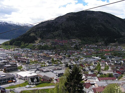
The regional centre of Sogn, with an airport, students and fruit farms on the slopes down to the fjord. From here the road continues to Flåm through the Lærdal Tunnel — the world's longest road tunnel at 24.5 kilometres, with blue-lit caverns along the way to keep drivers awake.
The facts
| Elevation | 10 m |
| Coordinates | 61.2297, 7.1003 |
| Time to allow | 3 h |
What to see
- Kaupanger stavkyrkje Sight
- De Heibergske Samlinger — Sogn Folkemuseum Museum
- Lærdalstunnelen Viewpoint
The world's longest road tunnel, 24.5 kilometres, with blue-lit caverns to keep drivers awake. - Storehaug Hike
- Fruktgårdane i Sogndalsdalen Food
Month by month
| Month | Daylight | Day high | Wet days | Access |
|---|---|---|---|---|
| January | 6.4 h | -0.5 °C | 18 | Open |
| February | 9.1 h | -0.1 °C | 16 | Open |
| March | 11.7 h | 2.8 °C | 17 | Open |
| April | 14.7 h | 7.1 °C | 14 | Open |
| May | 17.5 h | 11.8 °C | 15 | Open |
| June | 19.3 h | 16.9 °C | 16 | Open |
| July | 18.5 h | 19.7 °C | 18 | Open |
| August | 15.9 h | 18.5 °C | 18 | Open |
| September | 12.9 h | 14.1 °C | 16 | Open |
| October | 10.1 h | 7.7 °C | 17 | Open |
| November | 7.3 h | 2.2 °C | 16 | Open |
| December | 5.5 h | -0.6 °C | 18 | Open |
Background
Sogndal is a municipality in Vestland county, Norway. It is located on the northern shore of the Sognefjorden in the traditional district of Sogn. The village of Hermansverk/Leikanger is the administrative center of Sogndal Municipality.
Source: Wikipedia (CC BY-SA)
On these routes
- Otta–Flåm — Besseggen, Galdhøpiggen and the Sognefjell road — straight through Norway's high mountains, from the Dovre Line to the Bergen Line.