Sognefjellet
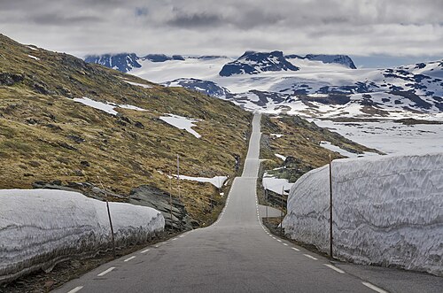
The highest paved mountain crossing in Northern Europe, 1,434 metres at its summit. The road was a packhorse trail carrying salt and fish between Sogn and Gudbrandsdalen for centuries before it opened to cars in 1938, and it runs through bare rock, snowfields and lakes that stay frozen well into June.
The facts
| Elevation | 1434 m |
| Coordinates | 61.5667, 7.9833 |
| Time to allow | 2 h |
What to see
- Sognefjellsvegen Viewpoint
The highest paved mountain crossing in Northern Europe, 1,434 m. A national tourist road. - Mefjellet Sight
- Sognefjellshytta Viewpoint
- Fannaråken Hike
Norway's highest staffed mountain lodge, 2,068 m. Five to six hours up and back.
In winter
Rv55 over Sognefjellet closes for the winter, normally from late October to early May. The detour via the Lærdal tunnel or down Ottadalen is not a longer way round — it is a different day.
Month by month
| Month | Daylight | Day high | Wet days | Access |
|---|---|---|---|---|
| January | 6.3 h | -8.7 °C | 17 | Closed |
| February | 9 h | -8.9 °C | 14 | Closed |
| March | 11.7 h | -6.8 °C | 15 | Closed |
| April | 14.8 h | -2.3 °C | 13 | Closed |
| May | 17.6 h | 1.8 °C | 13 | Open |
| June | 19.5 h | 7.1 °C | 17 | Open |
| July | 18.6 h | 11.1 °C | 19 | Open |
| August | 15.9 h | 10 °C | 17 | Open |
| September | 13 h | 5.5 °C | 16 | Open |
| October | 10.1 h | -0.8 °C | 16 | Open |
| November | 7.2 h | -5.8 °C | 15 | Closed |
| December | 5.4 h | -8 °C | 16 | Closed |
Background
County Road 55 (Norwegian: Fylkesvei 55) is a 248.1-kilometer-long (154.2 mi) highway which runs between Lom Municipality and Høyanger Municipality in Norway. The 108-kilometer (67 mi) section across Sognefjellet, known as Sognefjellsvegen, is designated a National Tourist Route. Also a short section from Balestrand to Norwegian County Road 613 is also a National Tourist Route over Gaularfjellet.
Source: Wikipedia (CC BY-SA)
On these routes
- Otta–Flåm — Besseggen, Galdhøpiggen and the Sognefjell road — straight through Norway's high mountains, from the Dovre Line to the Bergen Line.