Svartisen
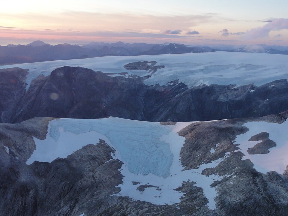
Norway's second-largest glacier. The Engabreen arm pushes down towards Holandsfjorden and ends barely 20 metres above sea level.
The facts
| Elevation | 1000 m |
| Coordinates | 66.6538, 13.8985 |
| Time to allow | 6 h |
What to see
- Svartisen Sight
Norway's second-largest glacier. The Engabreen arm reaches 20 m above sea level, closer to the sea than any other on the mainland. - Engabreen Hike
- Båt over Holandsfjorden Activity
In winter
The boat across Svartisvatnet runs in season, and without it the glacier front is a long walk along the lake. Nobody should walk out on the ice without a guide, summer or winter.
Month by month
| Month | Daylight | Day high | Wet days | Access |
|---|---|---|---|---|
| January | 4.2 h | -8.1 °C | 18 | Closed |
| February | 8.2 h | -8.6 °C | 17 | Closed |
| March | 11.7 h | -6.7 °C | 18 | Closed |
| April | 15.5 h | -2.8 °C | 16 | Closed |
| May | 19.5 h | 0.9 °C | 17 | Closed |
| June | Midnight sun | 6.2 °C | 18 | Open |
| July | 21.6 h | 10.1 °C | 18 | Open |
| August | 17 h | 9 °C | 20 | Open |
| September | 13.2 h | 4.9 °C | 19 | Open |
| October | 9.6 h | -0.9 °C | 18 | Closed |
| November | 5.6 h | -5.1 °C | 17 | Closed |
| December | 2.3 h | -7 °C | 19 | Closed |
Background
Svartisen is a collective term for two glaciers located in Nordland county in northern Norway. It is part of Saltfjellet-Svartisen National Park, located in the Saltfjell mountain range. The glaciers are located in the municipalities of Beiarn, Meløy, Rana, and Rødøy.
Source: Wikipedia (CC BY-SA)
On these routes
- Trondheim–Bodø — The Nordland Line crosses the Arctic Circle — ten hours north to Saltstraumen.
- Oslo–Tromsø — The length of the country: Dovrefjell, the Arctic Circle, Lofoten, and finally the aurora over Tromsø.
- Oslo–Bodø — From the capital across Dovrefjell and past the Arctic Circle to Saltstraumen.